
Nova Scotia · Ontario · British Columbia
Know the ground before you walk it.
Live claim maps, the geology under them, and the tools to stake and hold ground. One app, built for prospectors.
Built by Canadians, for Canadians


Free to download. The map, the layers and the claim data are not behind a paywall.
What it does
The map the registry should have built.
Every province keeps its tenure in one system and its geoscience in another: NovaROC and Fletcher in Nova Scotia, MLAS and GeologyOntario in Ontario, Mineral Titles Online and the BC Geographic Warehouse in British Columbia. They are built for a desk, and they stop working where the road does. Canada Prospector puts both sides on your phone, with or without a signal, and adds what the viewers leave to you: which claims are expiring, where the data lines up, what a block of cells will cost, and whether your assessment work is on track.
- Live claims
- Bedrock geology
- Surficial geology
- Faults
- Geochemistry
- Drill holes
- Mineral occurrences
- Abandoned mines
- Ice flow
- Restricted areas
- Crown land
- LiDAR hillshade
See the whole picture
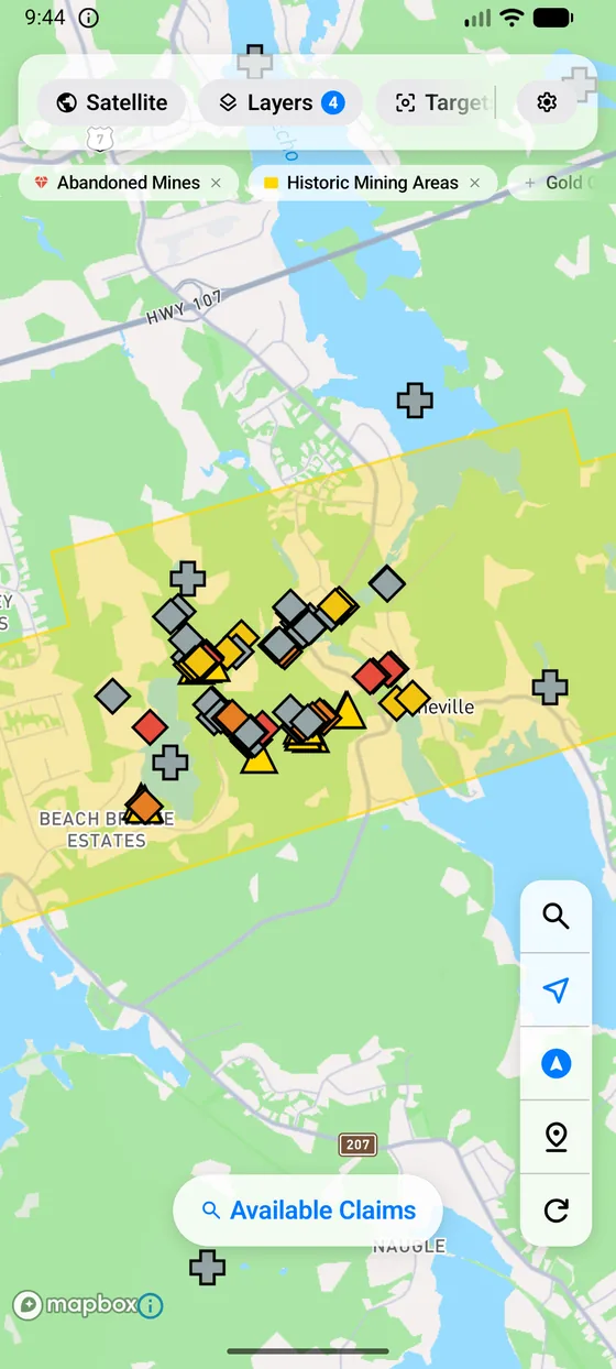
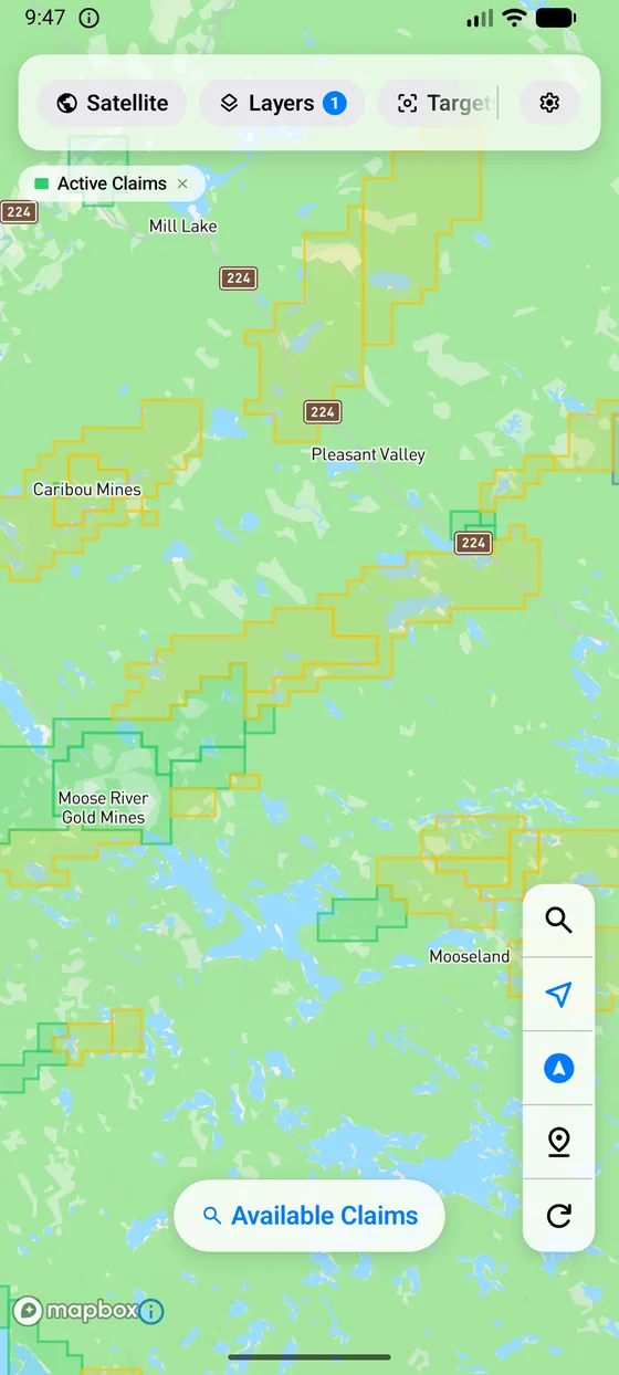
The live claim fabric for all three provinces, with holders, expiry dates and tenure history. Mineral occurrences, abandoned mines, drill holes, bedrock and surficial geology, faults and glacial ice-flow directions. LiDAR hillshade where the province publishes it.
Find open ground
See which claims lapse soon and watch the ones that matter to you. Draw a box on the map and get a push the day ground opens inside it. Get ranked exploration targets with an open-ground check, and tap anywhere for an instant read of the geology, the old workings and the claims at that spot.
Stake it
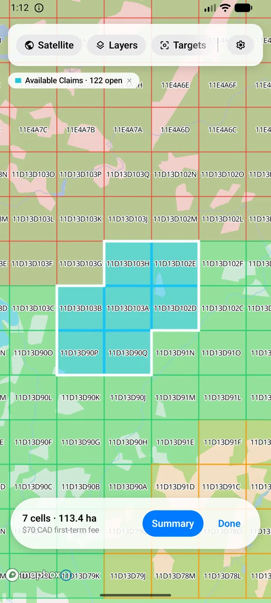
Frame an area, pick cells that meet your province's rules, and watch the fees add up as you go. Then read the cells off in the registry's own format, ready to paste into NovaROC, MLAS or Mineral Titles Online. The grid is free to browse; picking cells is part of Pro.
Keep your claims
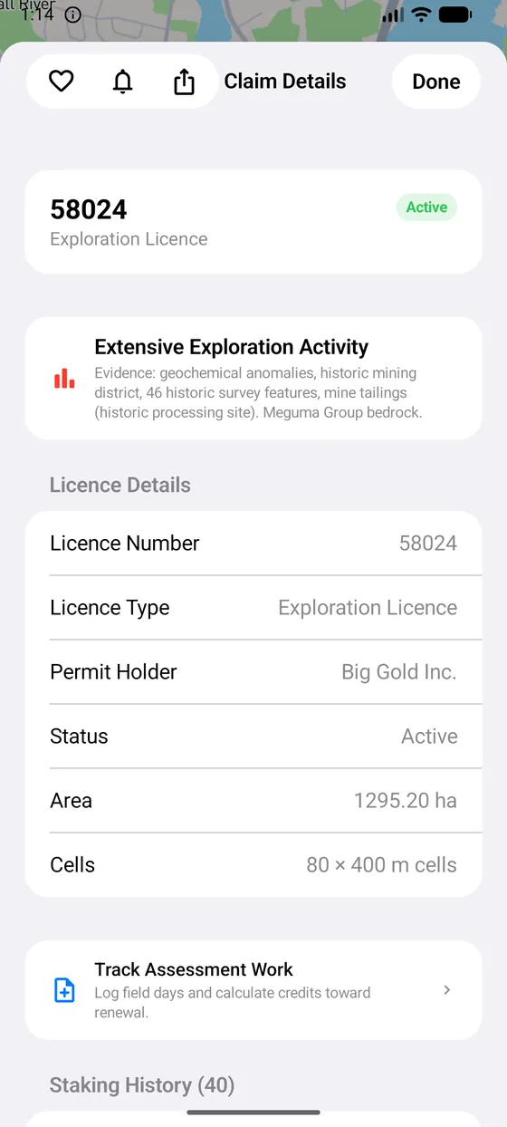
Track assessment work under each province's own regime: Nova Scotia licence terms and person-day credits, Ontario unit credits with receipts, British Columbia hectare work. Export the government forms filled in and ready to file.
Work without a signal
Claims are cached for 24 hours, so what you looked at over breakfast is still there at the outcrop. Your pins and notes work anywhere. With Pro, every bundled data layer works offline too. LiDAR and geophysics stream live tiles and need a connection.
Take it with you
Save favourites, drop field pins and notes, and export to KML, GeoJSON or CSV for Google Earth, QGIS or a partner. Your research is yours to take anywhere.
Tap anywhere
Know what's below your feet.
Tap any point on the map and get a read of that spot in one sheet: which claims cover it and who holds them, the bedrock unit, the nearest fault, geochemical anomalies, drill holes and old workings within reach, and the direction the ice moved. Answers in seconds, not an evening of switching between tabs.
Near Me does the same from your GPS position, listing occurrences, abandoned mines, drill holes and samples within the radius you choose, sorted by distance.
What the sheet tells you
- Claim statusActive, expiring or open, with the holder and the dates
- Bedrock unitFormation, group and age, from the province's own mapping
- Geochemical anomaliesStream sediment and lake sediment results nearby
- Drill holes and workingsWhat has already been drilled, dug or mined close by
- Fault proximityDistance to the nearest mapped structure
- Ice flowWhich way glacial transport came from, for tracing float to source
Open-ground alerts
Be the first to know when ground opens.
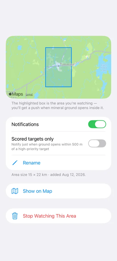
Draw a box on the map, or watch a whole province. When claims inside it lapse and the ground opens to new applicants, your phone gets a push, even if the app is closed and you have not opened it in a week. The registry is checked every night and the push goes out the next morning, so you know before the coffee is cold rather than when you next think to look.
- Watch a box or a provinceA box is the area you framed on the map, at whatever size you framed it. A province alert fires on any newly opened ground anywhere in it.
- Scored targets onlySkip the routine lapses. Turn this on and an alert fires only when ground opens within 500 metres of a high-priority prospecting target.
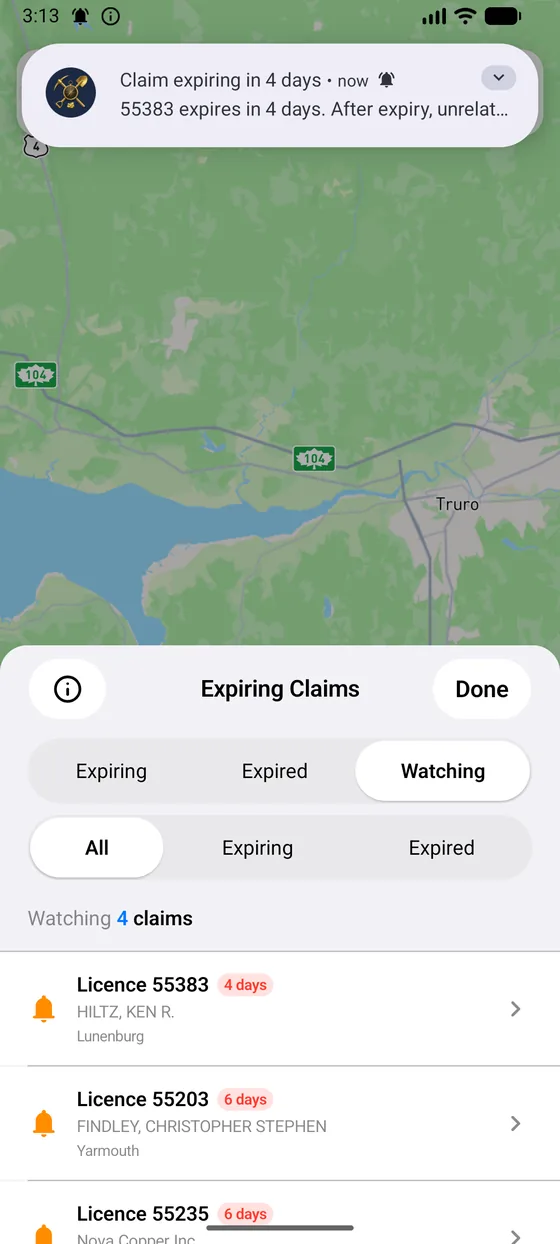
- Claim expiry remindersWatch a specific claim and get reminded 90, 30, 7 and 1 day before it expires. These are set on your phone and never leave it.
- One digest, not a floodOne notification per alert per run, listing what opened. Tap it and the app takes you to the map with the newly opened ground showing.
Open-ground alerts are a Pro feature. When ground opens is the registry's decision. Confirm availability there before you file.
In the field
Built for a phone in a wet glove.
Every screen below is the real app. Swipe through.
Three provinces, three sets of rules
Each province gets its own rules, not a rename of someone else's.
Tenure works differently in each province, so the guidance, the fees, the staking rules and the assessment math are written per province against the actual regulations. A claim sheet in British Columbia will never tell you to file in Nova Scotia.
Exploration licences & claims
The 16.2-hectare claim grid, NovaROC tract descriptions, licence terms and person-day assessment credits. Plus the Faribault 1898 to 1919 gold-district survey, which is not in the province's Fletcher map viewer.
- Registry
- NovaROC
- Assessment
- Credits per claim, per two-year term
Cell claims & unit credits
The MLAS cell grid, Geology Ontario mapping, AMIS and OMEIS records and the provincial hillshade. Assessment work under O. Reg. 65/18, with receipted costs organised into field programs and a cost summary export.
- Registry
- MLAS
- Assessment
- Receipted costs against per-claim units
Mineral titles & hectare work
Mineral Titles Online tenures over the BCGW fabric, MINFILE showings and BC's hectare-based work requirements, with a Statement of Work summary ready for your MTO filing.
- Registry
- Mineral Titles Online
- Assessment
- Work value per hectare, per year
Canada Prospector Pro
Tools the registry never had.
The free app already covers what the government portals do, on a phone: every map layer with its detail sheet, the staking grid, search, pins and notes. Pro is everything the portals never offered, for the work that comes after you find something worth chasing.
- Prospecting TargetsRanked locations where several independent data sources agree, filtered by commodity and by how many sources you require, with an open-ground check so you go to the field knowing, not guessing.
- Claim AssessmentMulti-layer prospectivity scoring for any claim in one tap, instead of cross-referencing the registry and the geology viewer by hand.
- Claim Watch & open-ground alertsReminders at 90, 30, 7 and 1 day before a claim you watch expires, and a push the day ground opens inside a box you drew or a province you watch, with an optional filter to targets only.
- Expiring ClaimsThe province-wide expiry list, recently released ground and your watchlist in one view, scored against the geoscience under them.
- Staking CalculatorPick cells on the grid under your province's rules, see the fee and the area as you go, and generate the tract descriptions ready to paste into the registry.
- Assessment Work TrackerLog field days, watch your credits build, and export the province's real government forms filled in and ready to file.
- Staking HistoryThe full chain of title for any cell from the provincial registry: who held it before you and what they were after, before you commit.
- Full What's Here analysisThe complete sheet for any point, including the geochemistry and drill hole sections the free app only previews.
- Near MeOccurrences, abandoned mines, drill holes and samples within a chosen radius of your GPS, sorted by distance.
- Faribault 1898 to 1919 SurveyNova Scotia's gold districts as the old-timers mapped them. More than 16,000 digitised shafts, veins, trenches, outcrops and structural readings.
- Offline field modeEvery bundled data layer and search work with no connection. LiDAR and geophysics stream live tiles and still need one.
- ExportKML, GeoJSON and CSV, for Google Earth, QGIS or a partner.
- Unlimited savesNo cap on favourites, pins, samples or field notes.
Where the data comes from
Public data, plainly credited.
Canada Prospector reads each province's public registry and open geoscience data, and draws the map with Mapbox. Some layers are live from the registry. Others ship as a dated snapshot so they work with no signal, and the app tells you which is which and when the snapshot was taken.
| Province | Tenure | Geoscience |
|---|---|---|
| Nova Scotia | NovaROC registry | NS Department of Natural Resources geoscience data |
| Ontario | MLAS | Geology Ontario / OGS, AMIS, OMEIS |
| British Columbia | Mineral Titles Online | BC Geographic Warehouse, MINFILE |
This app is not the registry. Canada Prospector is an independent tool and is not affiliated with or endorsed by any provincial government. Tenure changes daily, published data lags, and claim boundaries are approximate. Before you stake, file or spend money, confirm it directly with the province's registry. Nothing in the app is legal or financial advice.
Get the ground under you.
Canada Prospector is free on iPhone, iPad and Android. Download it, open the map, and see what is under your boots in Nova Scotia, Ontario and British Columbia.
Questions? Get in touch.